Arakan background history and styles
First, I’d like to voice my deep gratitude to the late Dr. Pamela Gutman, a Southeast Asia – Burma scholar who worked with and was a student of GH Luce. This book is currently the leading scholarship of this area. I also have a small paperback book I bought at the Mrauk U Archaeological Museum, one of 1000 copies printed in November 2007. It has been a great help in identifying some of the monuments and temples I took photos of. Between these two books and others, I am gaining a wonderful education and I hope I can share some of that with you.
Dr. Gutman’s credentials include being the first Australian to complete a Ph.D in Asian Art, specializing in Burma. Her scholarship promoted good relations between the Australian and Burmese governments from the 1970s onwards, “painting a picture of the art and cultural life of a hidden land.” She was born in Adelaide in 1944, later studying German, Philosophy, and Art History at the University of Vienna. After that she went to the Australian National University and studied Bahasa Indonesia, Old Javanese and Sanskrit. G.H. Luce, the foremost historian of Burma, sent Gutman to Arakan in 1972. She wrote her doctoral thesis on Arakan and received a Ph.D from Australian National University on the cultural history before the 11th century. Burma’s Lost Kingdoms: Splendours of Arakan was published in 2001.
Rakhine State, formerly Arakan
According to Ven. Ashon Nyanuttara in A Study of Buddhism in Arakan, 2014, “The exact origin of the word Rakhaing is unknown, though it is believed to be derived from the Pali “Rakkha,” meaning protector.” Then again, it could have come from an aboriginal people named “Rakhsha,” who were cannibalistic ogres “which used to live in the land times immemorial” (Nyanuttara, loc 1194). However, the modern Rakhaing people are a mix of the Indo-Arayans from the northeast and the Tibeto-Burmese from the Himalayas. Just a little bit later while describing the work of local Arakanese scholars,he states that the area described as Arakan is Rakkha, not Yakkha. Yakkha means uncivilized, cannibalistic ogres, who I wonder if they are the same as Rakhsha mentioned above. Additionally, the local historians and researchers, including U Oo Thar Tun, U Aung Tha Oo, U San Tha Aung and others, have looked for a linguistic background to the word “Arakan.” Etymologically, it is derived from a Pali word, “Arakkha.” The prefix “A” means adjacent and surrounding and “rakkha” means preserving, maintaining and protecting.
Arakan (or Rakhaing or Rakhine State) is located along the Bay of Bengal from the Naat River with Bangladesh on the other side, and Cape Negrais in southern Myanmar and then covering a narrow strip of land west of the Arakan Yoma, or range and bordered by Bengal on the east and Myanmar proper on the west. This geography created protected landscape suited to wet and dry rice farming, therefore encouraging the settlements of ancient peoples here.
Dr. Emil Forchhammer, a Swiss Pali scholar, surveyed Arakan in 1885 for the Indian government. His book was published 2 years after his early death in 1890. There is an original copy in the British Museum according to an article I read in the Kaladan Press Network, written by Aman Ullah, entitled, “Dr. Emil Forchhammer and Early History of Arakan,” published on 20 Feb 2016 in the Kaladan Press in Rakhine State. There are also 1970 reprint copies circulating in a few locations but in very poor condition, missing prints and all. I’d love to see the copy in the British Museum one of these days. For now, in this so far still open internet, you can find a digitized version here on archive.org.
Dr. Pamela Gutman’s book is a good read and an excellent introduction to the area, especially more so with Zaw Min Yu’s beautiful photos of the monuments. We never ventured outside of Mrauk U for the 5 days we were there, there was so much to see during that time. I’m looking forward to posting about temples, shrines and structures in Mrauk U. Here, I am giving a kind of an intro, mostly based on what I read in Burma’s Lost Kingdoms in Part I and the first three chapters of Part II.
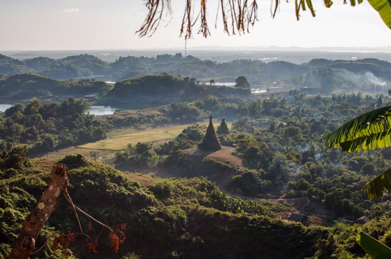
Mrauk U
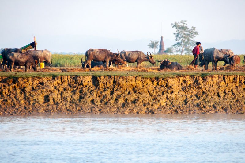
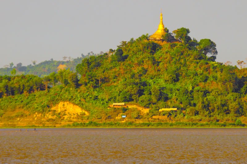
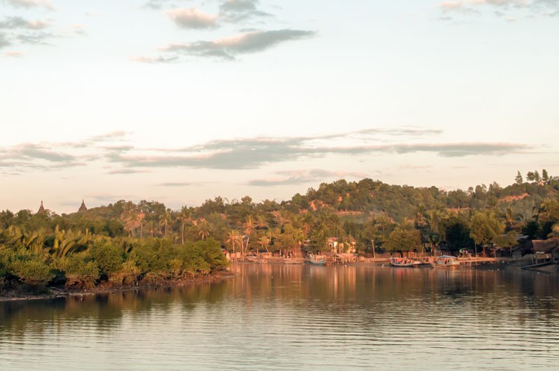
Mrauk U was declared a heritage area in 1996 by U Nyunt Han, the director general of the Dept of Archaeology in Myanmar. This was mostly due to tourist potential. My spouse and I were excited to visit in 2011 and having the opportunity to be inside of these somewhat ancient monuments. Because the area has a very long and rich history, and being located where it is on the banks of two rivers on the sea route between India, Sri Lanka(Ceylon) and Europe, quoting Ven. Nyanuttara, “…the natural boundaries of the mountains Rakhaing Roma and sea Bay of Bengal protecting a compact area suited to dry and wet rice cultivation factors…” which in turn led to the evolution of urban settlements by ancient peoples.

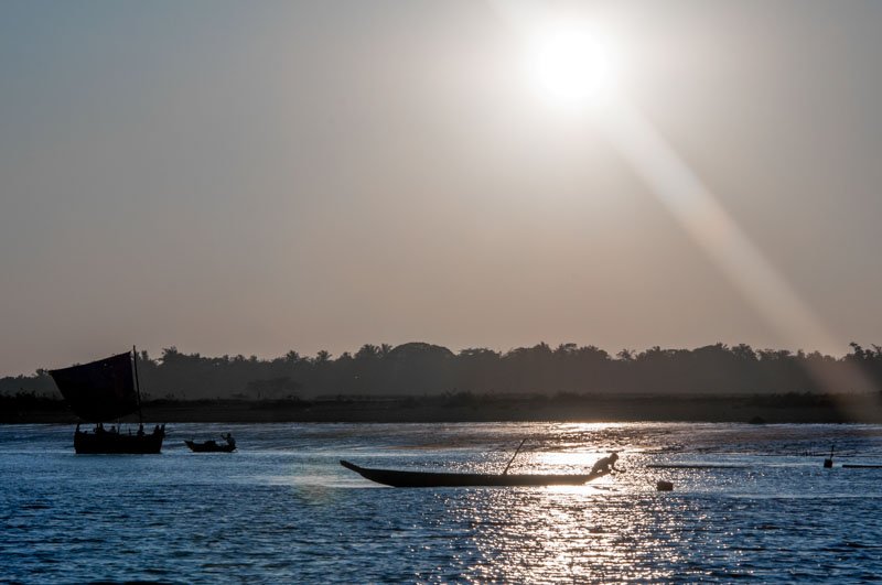
Trade was inevitable in this auspicious location as part of an archipelago on the convergence of the Kaladan and LeMro Rivers. At the temple of Shit-taung there is a stele or pillar inscribed by kings from 6th century and carried from capital to capital until it ended up in Mrauk U in the 16th century. In the beginning there was trading with China, sending gold to India and exotic other worldly items to Rome and the Middle East and back again.
Dhanyawadi and Indianization
The urbanization of Dhanyawadi, about six hours drive outside of Mrauk U, took place during the 4th to 6th centuries AD. According to Dr. Gutman, Indianization was a process taking place already for a millenium in India. It eventually made its way to Southeast Asia, including Burma, Thailand, southern Vietnam, Cambodia and western areas of Indonesia. I wondered if there was more recent scholarship on the subject and found Kenneth R. Hall’s book, A History of Early Southeast Asia published by Rowman & Littlefield Publishers in 2011. In his preface he says of John K. Whitmore, University of Michigan, in about 1971, “Whitmore challenged me to approach early Southeast Asia civilizations not as extensions of India (“Indianized States”) and China (Vietnam as a “Lesser China”), but as the products of indigenous cultures rather than displaced by them.” And then his study with Dr. Whitmore focused on maritime history rather than any specific civilizations, although he was fluent in Indonesia and Old Javanese studies (Hall, ix).
Maritime Trade
In the 3rd century AD, growing importance of maritime routes and trading spurred on a trip to Funan. In the 240s, the first China (Wu Dynasty) envoys made their way to Southeast Asia via sea passage, sailing to Funan along the southern Vietnam coast. Funan was prosperous at the time. The Chinese owned the waterways and the Southeast Asian (Malayo-Austronesian) seamen retained their loyalty by policing rather than pirating the coast. This brought trading and prosperity to their shores. The ships were large, able to carry 600 to 700 people and “ten thousand bushels, or nine hundred tons of cargo.” It used to be believed that Indian ships with Indian seamen developed the trading routes, but new evidence has come to be known. Malays built ships that made it all the way east to Africa, and so they could surely make it to India. Not only did the Southeast Asians secure their coasts, they also insured that European trade would not need to go beyond Southeast Asia (Hall, 45-46).
And so, by 1433 AD, when Mrauk U was founded, much has taken place in Arakan, Kings and Queens and Dynasties have come and gone, Buddhism flourished, amazing stone temples, shrines and monuments were donated and built for the next 255 years during the time of the Kingdom of Mrauk U. The next articles will be about Mrauk U, some of its history and archaeology and its Buddhist influenced architecture and sculpture.